Location of Oceania
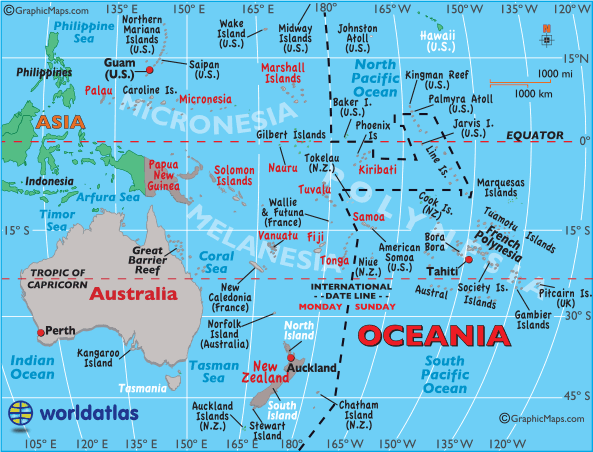

Latitude: (shown as a horizontal line) is the angular distance, in degrees, minutes, and seconds of a point north or south of the Equator. Lines of latitude are often referred to as parallels.
Longitude: (shown as a vertical line) is the angular distance, in degrees, minutes, and seconds, of a point east or west of the Prime (Greenwich) Meridian at 0°. On the other side of the planet in the Pacific Ocean the 180° line of longitude is the ending point. Lines of longitude are often referred to as meridians.
Oceania Latitude and Longitude examples: (see map)
| Auckland, New Zealand: | 36° | 50' | S | / 174° | 45' | E |
| Hagatna, Guam | 13° | 28' | N | / 144° | 45' | E |
| Papeete, Tahiti: | 17° | 32' | S | / 149° | 34' | W |
| Perth, Australia: | 31° | 57' | S | / 115° | 51' | E |